
Cabell County Neighbors by Record
The immediate block around a Cabell County address appears in several public sources, each with a narrow purpose. Assessor maps show parcel geography. Tax records connect a taxpayer or account to a parcel and year. The voter system confirms a registrant’s own current status, while a formal voter-data request has statutory limits. Huntington’s neighborhood inventory names civic groups and public contacts. None is a complete list of neighbors.
| Local source | Block-level contribution | How it is reached |
|---|---|---|
| Assessor tax maps and GIS | Adjacent parcels, district, map, parcel, roads, and assessment layers | Assessor maps page and public viewer |
| Cabell Sheriff tax portal | Taxpayer/account, tax year, parcel filters, and payment status | Public tax search |
| Voter records | A permitted list can include name, residence address, party, and status | State request form, subject to law |
| Neighborhood organizations | Association name, meeting route, public contact, and local focus | City inventory |
| Historical directories | Dated street and house-number entries for an earlier block | Cabell library and West Virginia Archives |
Keep “owner,” “taxpayer,” “registered voter,” and “association contact” as separate labels. A mailing recipient may not live at the property. A tax class is a tax-system classification, not conclusive occupancy proof. Association participation is voluntary. If the question is simply who owns the two adjoining lots, parcel and deed records may answer it. If the question is who currently lives there, public records can remain incomplete.
Read Cabell County Parcel Records
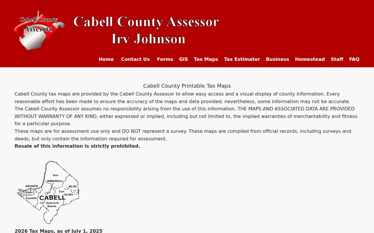
The Cabell County tax-map index supplies static district sheets and links for current and prior years. District choices include Barboursville, Grant, Guyandotte, Gideon, Huntington Guyandotte, Kyle, Mc Comas, Milton, and Union. These labels help keep two similar road names or parcel numbers from being mixed.
The sample Kyle map shows roads, rights-of-way, original lots, parcel numbers, rail, water, and government lines. It also states that the assessment map is not a survey and was not field verified. Use those lines to orient the block, not settle a boundary dispute. A deed and licensed survey serve different purposes.
The public tax-map index appears in this source capture.
Map Cabell County Neighbors Outward
Begin at one verified address in the Assessor’s GIS viewer, then move parcel by parcel. The research capture did not expose the viewer’s internal search-field labels, so do not assume a radius or buffer tool exists. The safe method is to select the known parcel, record its identifiers, and inspect only the visibly adjoining parcels.
- Normalize the street number, directional, street type, unit, city, state, and ZIP before searching.
- Locate the address through the Cabell County GIS viewer. Save district, map, parcel, and subparcel.
- Select each parcel sharing an edge or facing the target. Record only fields needed for the block question.
- Compare the owner field with the tax record and, when needed, the deed index. Do not turn a mailing address into an occupancy claim.
- Stop at the immediate block. A full corridor belongs in the named-street workflow.
The Cabell County street directory covers the broader street-by-street chain. Here, the narrower block method reduces false matches and unnecessary collection of personal data.
Cabell County Neighbor Roles Differ
The Sheriff portal accepts a taxpayer name or account plus tax year, ticket, district, map, parcel, and subparcel. It separates real from personal property and paid from unpaid status. Those controls make it useful for confirming that the same parcel is in view. They do not make it a household directory.
- Parcel
- A unit of land identified in the assessment system.
- Situs address
- The physical property address shown by a record keeper.
- Mailing address
- The destination used for notices, which can differ from the property.
- Owner of record
- The party shown in the current official record, subject to later filings and corrections.
Class 2 is described by the assessor as owner-occupied, while classes 3 and 4 are non-owner-occupied for tax purposes. Report the class as the record shows it. An estate, company, lender, or relative may appear in another related field, and a recent transfer may not yet align across each system.
Note: Join assessor and tax results by parcel identifiers, not by guessing that the same surname means the same neighbor.
Cabell County Neighborhood Contacts
The City of Huntington neighborhood inventory is the best current community layer found in the research. It identifies groups, public meeting routes, and association contacts. It does not claim every household belongs, and it should never be used as a private member directory.
| Community group examples | Useful public purpose |
|---|---|
| Old Central City and West Huntington | Historic place names, public meetings, and civic issues |
| Guyandotte Improvement and Historical Association | Local history and current community identity |
| Enslow Park, Highlawn, and Southside | Neighborhood-level contact and meeting leads |
| Westmoreland and Gallaher Village | Public association routes for local questions |
The Neighborhood Institute of Huntington holds open board meetings on the second Monday each month. Ask an association for public minutes, published history, or the right public contact. Do not ask for an unpublished household list. The city’s 2025 planning map also shows associations and study areas, but those shapes are planning references, not legal parcel boundaries.
The planning inventory adds Arlington, Chancellor Hills, Downtown, Fairfield East, Forest Hills, Inwood Garden Club, Walnut Hills Action Team, and other named groups. Its study areas include Downtown Marshall, Guyandotte Altizer, Southeast Hills, Southern Hills, and Southside Enslow Park. A group name can narrow a local-history question or identify a public meeting. It cannot place every Cabell County neighbor inside a fixed boundary. Record the date of the city page because contacts, schedules, and active groups can change.
The Huntington organization page is shown in this capture.
Historic Labels Shape Cabell Blocks
Central City and Guyandotte can make an older block look as if it moved. Central City existed as a separate city from 1893 to 1909 before annexation by Huntington. Guyandotte appears in an 1889 Sanborn edition and in later neighborhood and planning sources. Search the historical label beside the modern Huntington form.
The Library of Congress Sanborn collection includes Huntington-area editions from 1884 through 1954. These maps can show street numbers, building footprints, construction details, and institutional names. They cannot identify present neighbors. Record the edition and sheet before connecting an old structure to a current parcel.
Cabell County also includes Barboursville, Culloden, Lesage, Milton, Ona, Pea Ridge, and Salt Rock. Branchland and Glenwood appear as postal communities in the local health assessment. These terms do not all describe the same kind of place. Some are municipalities, some are communities, and others are postal labels. State which kind is meant when describing a block. A Huntington neighborhood association should not be stretched into a countywide source, and a postal city should not be treated as a legal municipal boundary.
Cabell County Neighbor Data Limits
West Virginia’s individual voter lookup asks for first name, last name, and date of birth. It returns registration status, party, districts, and polling place from the most recent county entry, and is updated nightly. That tool is for checking a registration, not browsing a block or reconstructing residence history.
A formal voter-data request can cover monthly statewide lists, daily pre-election updates, voter history, absentee files, and early-voter products. Under West Virginia Code §3-2-30, protected fields include Social Security, driver’s-license or state-ID, telephone, and email data. The law also restricts solicitation, advertising, and resale. Request only a permitted product for a lawful civic or research purpose.
Even an allowed list is a dated registration record, not a census of the block. A status may change after the file date, and one address can contain people who are not registered. Keep the product name, request date, and stated purpose with any excerpt. When the goal is to verify a person’s own polling place, use the individual lookup instead of collecting a larger list.
Official Cabell County Neighbor Sources
Official sources are slower to combine because they keep record roles visible. That separation is useful. Commercial neighbor tools may merge old addresses, telephone listings, and other feeds without a clear date or custodian. Treat that category as an unverified lead, not proof.
| Choice | Strength | Main caution |
|---|---|---|
| Assessor, tax, and deed sources | Named custodian, parcel context, record date, and defined fields | Ownership and payment records do not prove occupancy |
| Community organization pages | Current public contacts and local meeting information | Voluntary participation is not a block roster |
| Commercial compilation | May offer a quick name or address lead | Source dates, roles, corrections, and completeness may be unclear |
For a Cabell County neighbor question, use the smallest official record that answers it. Save the source date and role. If two sources conflict, return to the parcel identifier and custodian instead of adding more loosely matched names.
Protect Cabell County Neighbors
Public availability is not permission to build a complete household profile. Utility and delivery data are not public neighbor rolls. Recent vital records are restricted. Adoption files are sealed, and the mutual-consent registry is not public. West Virginia’s Address Confidentiality Program can provide a substitute address for eligible victims.
Minimize what you retain. A parcel ID, source date, and owner role may be enough for a property question. Do not republish birth dates, private contact details, protected addresses, or unrelated case facts. A corrected deed or newer tax year may also change an earlier conclusion.
Lawful use. Cabell County neighbor records support civic awareness, local history, and ordinary property questions. Never use them to watch, threaten, intimidate, or harass anyone.