
Walk a Cabell County Street
A sound Cabell County street search begins with the exact address as it appears in the newest source. Keep the house number, directional, street type, unit, postal city, and ZIP in separate notes. The county's records do not form one live household list. An assessor map identifies parcel geography, the sheriff portal identifies a tax account, and the clerk index records legal instruments. Those facts may point to an owner or taxpayer, but neither label proves present occupancy. A directory entry or voter record is also dated evidence, not a promise that the person remains there.
Work from the lot outward. This sequence makes the street directory useful without merging unlike records:
- Open the Cabell County Assessor and locate the map or GIS route for the address.
- Record the district, map, parcel, and subparcel exactly. Browse adjoining map sheets when the street crosses a district line.
- Check the Cabell Sheriff tax portal by those parcel fields and note the tax year and account status.
- Search the Cabell County Clerk index by grantor and grantee, then follow book, page, instrument, and legal-description clues.
- For a dated household clue, consult a city directory and compare its printed address with a period map.
The official public voter lookup is built for a voter checking his or her own registration through name and birth date. It is not a street browser. Requested voter-data products have separate statutory rules, so do not treat them as a casual neighbor list. For one named person, the West Virginia voter lookup can confirm current registration facts when used as intended.
Cabell County Street Parcel Fields
The assessor's tax-map index is the stable starting point when an address is incomplete. Its current and prior-year map links are organized by district and sheet. A sheet may show a parcel or lot without a full delivery address, which is why the identifier should be saved before searching another system. The interactive GIS viewer adds map context, while the assessor warns that its maps are for assessment and are not surveys.
| Field | Use in a street search | Key caution |
|---|---|---|
| District | Selects the local tax-map group | A street may cross districts |
| Map | Identifies the assessment sheet | Not a legal survey |
| Parcel / subparcel | Connects map and tax searches | Do not replace it with a guessed address |
| Tax year | Dates the taxpayer result | Status can change by year |
| Paid / unpaid | Filters tax tickets | Does not prove residence |
The Cabell County tax-map index also preserves previous-year links. That can help explain a parcel change, but a split or boundary question still belongs with the assessor and the recorded plat or deed.
View the official tax-map route below before moving from a street name to a parcel number.
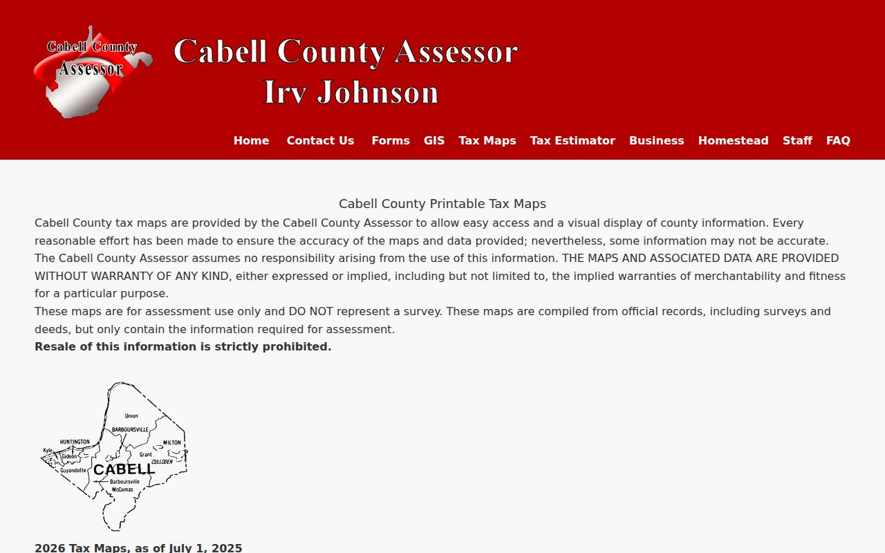
The district and map links shown there are the bridge between a visible block and the identifiers used in county tax records.
Cabell County Records Linked by Address
No single Cabell County street directory supplies all of these layers. Use the street as the shared reference, but preserve each source's date and label. A taxpayer, owner, mailing recipient, registered voter, business agent, and directory resident may be different people.
| Record Set | Keeper | What It Shows | Access |
|---|---|---|---|
| Assessment maps | Cabell County Assessor | District, map, parcel and geography | Free web maps and GIS |
| Tax tickets | Cabell County Sheriff | Taxpayer, account, year and payment state | Free public search |
| Deeds, liens and plats | Cabell County Clerk | Recorded parties, dates, book/page and instrument | Web index; clerk fallback |
| Historic directories | Library and WV Archives | Dated name and address entries | Online scan, staff request or archive |
| Building permits | City of Huntington | Permit process and dated project records | Current permit-center route |
When the online clerk index fails, search both exact and starts-with name modes, widen the date range, and inspect the Deeds, Liens, Estates, UCC, and Misc categories as relevant. Image access and coverage vary. The interface permits a start date of 1900, but that control is not proof that every record category is complete from 1900. Call or visit the Cabell County Clerk for an older book or an image not exposed online.
Cabell County Street Address Language
Four terms prevent common errors in a by-address search. Define them before copying fields between systems.
- Parcel
- An assessment unit identified by district, map, parcel, and sometimes subparcel. It is not the same thing as a household.
- Situs address
- The physical location assigned to property, which can differ from the owner's mailing address.
- Plat
- A recorded drawing that shows lots, boundaries, streets, or subdivisions. An assessor map is not a substitute for it.
- Criss-cross directory
- A directory arranged by street or address instead of surname. No official Cabell County run was confirmed in the research.
Retain the source wording. If a deed supplies only a legal description or lot number, do not force it into a postal address. If the tax portal gives a mailing address, do not relabel it as the parcel's situs address.
Cabell County Streets Across Time
Huntington's planned grid uses numbered streets and avenues, with “West” often serving as a suffix in the western part of the city. Historic print can shorten Third Avenue to “3d av” or reverse the order in “14th St W.” Preserve that printed form, then add a separate normalized form. Central City requires special care: it was a separate city from 1893 to 1909 before annexation by Huntington, and Old Central City remains a community label.
Guyandotte is another lasting historic label. The Library of Congress Sanborn collection has editions for 1889 Guyandotte and later sheets covering Guyandotte, Central City, and Ceredo. Compare the directory year with the closest map edition and today's parcel map. That three-source match is an inference about continuity, not an official renumbering record. No authoritative countywide renumbering year or courthouse-fire loss was found, so neither claim should be attached to a Cabell County address.
Note: Keep both the historic place label and its current Huntington relationship whenever a dated source supports the connection.
Deeds Along Cabell County Streets
A deed chain turns a modern parcel into a sequence of recorded owners. In the clerk portal, a grantor is a party giving an interest and a grantee is a party receiving it. Begin with the current name from the assessment and search that person in both roles. Save the document date, document type, book and page, instrument number, and description. Then use the prior grantor as the next search name.
Corrective deeds, easements, liens, and plats can explain why the same address appears under different legal wording. They do not all transfer ownership. Read the document category and party role before drawing a conclusion. For an older record, the clerk counter and archive route matter because web coverage and images differ by category. A certified copy, when needed, must come from the custodian rather than a screenshot.
Cabell County Street Directory Crosswalk
The digitized 1891–92 Huntington city directory provides a rare address crosswalk. Potts & Cammack's volume includes an alphabetical resident list, a business section, city facts, street information, and advertising. Its 174 scanned pages are more reliable than the OCR text alone, which can drop letters or merge columns.
Start with the printed entry and copy its exact abbreviation. Next, consult Marshall University Special Collections for the 1891 Huntington Transit Book, a survey of city streets. Then place the block on the nearest Sanborn edition. Only after those dated sources agree should the modern assessor map and clerk index enter the comparison. This method can explain an address mismatch without inventing a date when a number supposedly changed.
A full account of the historical shelf belongs in the Cabell County city directory collections. Here, the volume serves one purpose: connecting an old printed address to a present street and parcel.
Read Cabell County Street Pages
The scanned volume lets a researcher enlarge the real page and compare adjacent entries, headings, and abbreviation keys. Open the source before relying on a text-search hit.
The image route helps distinguish a true street listing from OCR that has joined two columns or cut off a house number.
Huntington Permits by Address
The City of Huntington building-permit page is a current route for permit processes and ePermits material. Permit records can add a date, project type, contractor, or property reference to a street timeline. They should be described as project records, not a resident roll. The named applicant or contractor need not live at the site.
If the published route does not expose an older record, request a narrow address and date range from the city custodian. Ask for the permit number, issue date, work description, and public supporting record. West Virginia FOIA provides an inspection and request framework, but exemptions still apply and reproduction costs may be charged. A tight request is more useful than asking for every person ever linked to a block.
Limits of Cabell County Street Records
A Cabell County street directory cannot certify who sleeps at an address, who belongs to a family, or who has moved. Assessment and deed records concern property interests. Tax records concern an account. Historic directories capture what a publisher printed at one date. Voter access is bounded by law, and the public list excludes Social Security, driver's-license or state-ID, phone, and email fields. Protected, sealed, or confidential records remain outside an address search.
Commercial neighbor tools may merge stale files, old phone listings, and guessed relatives. Official sources are narrower but state what created the record and when. Use the assessor for parcels, the clerk for instruments, the city for permits, and the library for dated directory evidence. Never fill a gap by assuming that a mailing recipient, taxpayer, registered agent, or former directory listing is the present occupant.
Lawful use. Use Cabell County address records only for lawful personal research, and never to stalk, harass, intimidate, or harm anyone.
When a source is unclear, contact its custodian and describe the exact record, address, and date sought. The web index is a finding aid. The underlying public document, map, or librarian-reviewed page is the evidence.
Keep four address forms separate in the notes: the situs address on an assessment record, the mailing address tied to a tax account, the legal description in a deed, and the printed address in a dated directory. They may point toward the same parcel while answering different questions. A map-and-parcel identifier is often the safer bridge when a Huntington street suffix, old community label, or house number does not line up.
Cabell County's official fallback channels matter here. Visit or contact the Assessor for map interpretation, ask the County Clerk for a cited instrument or older index, use the City of Huntington permit contact for a defined project record, and give library staff an exact date range for historical material. Preserve the office response and access date. That record trail makes a by-address conclusion testable without pretending the Cabell street directory is a live household census.